Editor's Note: This piece, written by environmental journalist Laura Paskus, comes from the December issue of the Utton Center's Environmental Flows Bulletin.

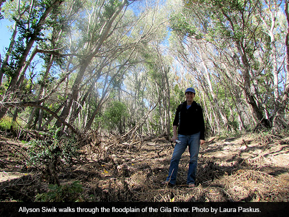
One word comes to mind as Allyson Siwik walks through the floodplain of the Gila River above the towns of Cliff and Gila: Flattened.
In early October, the sky is a brilliant blue and the cottonwood leaves are just beginning to show a bit of yellow. Meanwhile, signs from last month’s floods are all around: Grasses and bushes are bent flat against the muddy soil. Downed trees and debris piles choke what may once have been a path. Meanwhile, the Gila is calm, running at 68 cubic feet per second—down from a peak of 12,400 cfs less than a month earlier when prolonged rains sent the river swelling. “Healthy rivers are better at mitigating floods,” says Siwik, pointing toward the messy floodplain all around. “The water came up, spread out over that area; it reduced the velocity of the water and also recharged the groundwater.”
Most days of the year, the Gila is what people from other regions of the United States would probably call a stream. Or maybe a creek. But for 13 days in September, its flows ran above 1,000 cfs. (And for three days, it was above 4,000 cfs.) The flooding here, as well as within many of its tributaries, showed what the river could do. “The Gila River is what makes southwestern New Mexico so special,” says Siwik. “It’s America’s last wild river.”
More than 30 years ago, New Mexico was promised access to 18,000 acre feet of Colorado River water. All New Mexico needed to do was find a downstream water user in Arizona willing to trade Gila and San Francisco River water for Colorado River water. New Mexico didn’t find that partner until 2004, when Congress passed the Arizona Water Settlements Act (AWSA) of 2004. That law created a procedure allowing New Mexico to use that water. In 2004, the amount of water was reduced to 14,000 acre feet, to account for consumptive use. And technically, it’s 140,000 acre feet over a ten year period, with a maximum annual diversion of 64,000 acre feet.
Under AWSA, New Mexico would pay an exchange fee for the water from the Gila River Basin, which would allow Arizona’s Gila River Indian Community to take advantage of its Colorado River water from the Central Arizona Project. The federal government set aside two funds for New Mexico: $66 million spread across ten years to develop water projects that meet water supply demand in the state and another $34 to potentially build a diversion and storage project for the Gila waters. The funds are paid by the U.S. Bureau of Reclamation and administered by the New Mexico Interstate Stream Commission (ISC), whose nine members are appointed by the governor.
Over the past two years, ISC staff members have evaluated applications for a variety of projects, ranging from conservation programs to diversion plans. Today, the projects have been whittled down to 15, which staff are evaluating for technical feasibility and design options, environmental impacts, cultural considerations, economics, and water supply. In January, they will report to the legislature, then issue a final report on studies mid-way through the year. The commission will issue its preliminary decision in August, 2014 and a final decision in November. If the commission decides New Mexico will undertake a diversion and storage project on the Gila, it must notify the U.S. Secretary of the Interior by December 31, 2014. If New Mexico chooses not to divert water, it will receive only $34 million of the $62 million.
Whereas environmental groups, such as the Gila Conservation Coalition and the Center for Biological Diversity, have long opposed diversion, ISC Deputy Director Craig Roepke says the Arizona Water Settlements Act “provides the opportunity to turn period drying (on the Gila) to a continuously flowing, healthy river.” According to Roepke, development will also benefit the riparian habitat, farmers, and the regional economy.
At the end of October, Roepke, along with ISC staffers Helen Sobien, Ali Effati, and David Anderson shared a presentation about AWSA with the Utton Center.
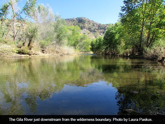
“When people picture the Gila River, they picture wilderness, green, and a flowing river,” says Roepke. “But near Redrock, the river is bone dry.” There are seven major irrigation diversions off the river, the uppermost of which are in the Cliff-Gila Valley. A stretch of the river ran dry in the Cliff-Gila Valley in June, 2013, says Roepke. When that happens, there is a shortage of water for both agricultural and environmental needs. Not only that, he says, but there’s a “false sense of security” regarding the stability of the Mimbres Aquifer, which supplies water to both Silver City and Hurley. (Information about the ISC’s refutation of an earlier US Geological Survey about the aquifer is available within the presentation given to the Utton Center.) Developing the Gila Basin’s water would also protect towns and cities, he says.
Roepke also points out that a diversion wouldn’t take all the water from the river. Under the terms of the Conservation Use and Forbearance Agreement of the AWSA, New Mexico must allow minimum bypass flows. Under the law, at most, New Mexico can divert 350 cfs from the river, and the ISC has said it will only take water from the river when flows exceed 150 cfs. (In addition, New Mexico cannot divert water unless there is at least 30,000 acre feet of water stored in Arizona’s San Carlos Reservoir.)

To better understand the region—and using money from that first pot of federal money—the ISC has already funded 22 different studies, including those related to hydrological models, streamflow projections, riparian health, and climate change.
Those studies are crucial to understanding the river and its future. For example, in a recent draft report to the ISC, Dr. David Gutzler, professor in the University of New Mexico’s Earth and Planetary Sciences Department, points out that the Gila is “arguably the southernmost snow-fed river” in North America. Summer flows are augmented by monsoon rains. According to Gutzler, the flows of southwestern snow-fed rivers are expected to decrease due to the warming temperatures projected to occur over the next century. Already, the area has experienced a two-degree Fahrenheit temperature increase for January through April since the 1930s.
From 1929 through 2012, the annual average flow at the Gila gage was 155.6 cfs. According to Gutzler’s draft, by 2021-2050, the upper Gila River will see a reduction in flows of about eight percent during the peak-flow season. The timing of peak streamflow and the shape of the hydrograph will also change over the next several decades. As temperatures continue to increase, snowpack will diminish. And as cold season precipitation becomes runoff immediately—rather than accumulating as winter snowpack, then melting in the spring—spring season flows will decrease in the basin.
But Roepke isn’t worried that diminished flows in the future will affect New Mexico’s ability to divert and store water. According to his projections, even with a 30 percent reduction in flows, New Mexico would still be able to divert 9,661 acre feet annually.
During the September flooding, for instance, New Mexico could have taken out about 28,000 acre feet of water. “We’re not talking about cutting it off and taking everything like with a mainstem dam,” says Roepke. Rather, he points out that a diversion would skim water off the top of the flows.
In a followup email, Roepke adds that diverting, storing, and releasing water for environmental needs is “neither new nor exceptional.” Many projects, including those along the Colorado and San Juan rivers that allow spring water releases for fish spawning, are designed so dam operations help meet ecological needs. “Releasing water from storage to meet environmental needs is old hat,” he writes.
The difference with AWSA, he writes, is that the AWSA diversion and storage proposals would be designed to protect both “people and the environment.”
But the science is clear: flow alteration is the primary driver of the degradation of aquatic communities. In a 2010 paper in Frontiers in Ecology and the Environment, researchers assessed streamflow alterations at 2,888 monitoring sites in the U.S. Mean annual streamflows were altered in 86 percent of those streams. According to the paper, “diminished flow magnitudes were the primary predictors of biological integrity for fish and macroinvertabrate communities.” In addition, the likelihood of impairment doubled with the increasing severity of diminished streamflows.
Since the early 1980s, biologist David Propst has worked with two endangered fish that still survive in the Gila River, the loach minnow and the spikedace. The situation is particularly serious for the spikedace, only three populations of which remain, says Propst. And they’ve become increasingly rare in the stretch of the river through the Cliff-Gila Valley, a place that was once a stronghold for the fish. In August 2012, following the Whitewater Baldy Fire, they sampled the valley and found several fish. In October 2013, the fish wasn’t found at any of the four sites it had previously populated.
Retired from the New Mexico Department of Game and Fish, Propst remains involved with fish studies in the area. He says there are better solutions to keeping water in the stretch of the Gila that dries in the summer “If the State Engineer’s Office properly enforced diversion rights, that would reduce the drying,” he says. “They’re diverting more that they’re entitled—whether they’re doing that to maintain the head or to put on fields—and they’re diverting water all 12 months of the year.”
Taking care of the river—and serving the needs of the farmers—doesn’t require an upstream diversion and storage facility, says Propst. Rather, irrigation diversions could be better regulated and also updated to be more efficient.
He also disputes the position of the ISC that diversion and storage would be environmentally beneficially to the river and riparian habitat downstream. “I defy them to come up with one example where you have a cross-channel structure, a diversion or a dam, that does not have demonstrably negative effects on downstream flora and fauna,” he says. “They’re grabbing for straws.”
For more information:
The Interstate Stream Commission’s New Mexico Arizona Water Settlements Act website:
http://www.nmawsa.org/
The Grant County Beat covered the October 21, 2013 ISC AWSA public meeting in a six-part series of stories. The first part is available online at: http://www.grantcountybeat.com/index.php/news/news-articles/12834-isc-awsa-quarterly-public-meeting-102113-part-1
Draft report by Dr. David Gutzler estimating streamflow reductions in the Upper Gila River due to climate change:
http://nmawsa.org/ongoing-work/draft-stream-flow-projections-for-the-upper-gila-river/view
December 2012 issue of Environmental Flows Bulletin:
http://uttoncenter.unm.edu/EFlows/EFlowsDec12.pdf
 Laura Paskus is an independent writer, editor, and radio reporter based in New Mexico. Her work has appeared in Ms., New Mexico Magazine, The Progressive, Columbia Journalism Review, Women’s eNews, High Country News, Santa Fe Reporter, New Mexico Independent, The Mountain Gazette, Forest, Audubon, Orion, and Law & Politics.
She also reports and produces radio stories for KUNM 89.9 and reports for New Mexico In Depth’s Native America Project.


Responses to “Damming a River to Save It”